Sage Thrasher is an endangered songbird that nests in large sagebrush vegetation. As part of efforts to conserve this species, the Canadian Wildlife Service initiated a pilot study to investigate the efficacy of using Unmanned Aerial Vehicles (UAVs) to map and monitor critical Sage Thrasher nesting habitat.
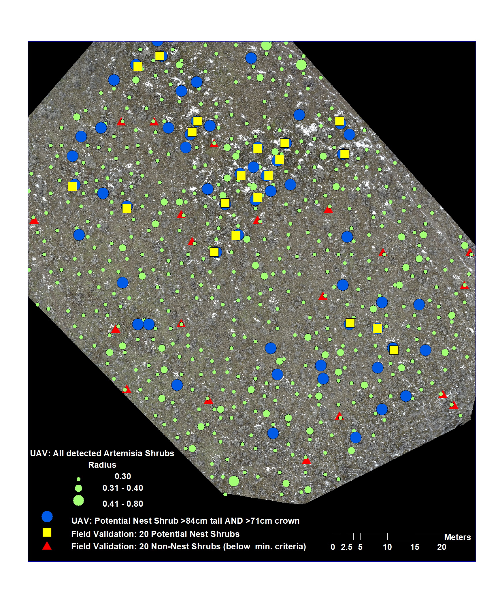
A pilot project was undertaken in two locations in southern B.C. where Sage Thrasher critical nesting habitat had been previously identified to test the efficacy of using UAV imagery to identify and map potential nesting sites.
We used 3D point-cloud data to separate terrain features from vegetation features in an attempt to discriminate large sagebrushes that meet Sage Thrasher nesting criteria. The analysis resulted in the production of map layers that identified sagebrush position, height, and radius, allowing for quantitative analysis of habitat suitability over the flight area.
This method correctly identified a large proportion of the sagebrush habitats that had been identified in the field as critical nesting habitats. These findings suggest that the UAV method offers a reliable alternative to more labour intensive ground-based surveys, and can support the identification of additional locations where nesting habitats should be managed for this critically endangered species.
